Unarguably the most difficult part of this process was the in class instillation of the Landsat software. That is to say that using this landsat …software I guess you would call it? …is incredibly easy and dare I say fun to use.
For the assignment, I just wanted to make sure I could use Landsat efficiently and effectively while understanding what was actually happening. My first attempt at using it, I decided to pull in my exact location in Brooklyn. I started by going to www.latlong.net and finding my exact location:
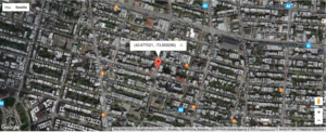
I took the screenshot because I was curious to see just how precise the landsat imagery was going to be. I obviously wasn’t expecting the specificity of a street level view but I was anticipating I could make out some geographical features that would lead me to believe: “Oh, this Brooklyn.”
I took the first 6 digit of the lat and long, and input that into my terminal. After the JSON information loaded, I chose the scene ID that seemed to have the most minimal amount of cloud coverage, used that to download and process some bands and got this image:
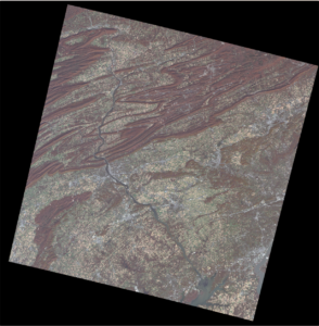
This does…not look like Brooklyn to me. Doesn’t look like any area that I know in NY. I decided I’d try it again with another familiar image: my home in MD. This time however, rather than taking just 6 digits from lat and long, I took the entire lat long as found by the same aforementioned website.
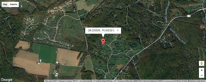
Here is my before image:
And here is the processed image when the exact lat/long was placed in the landsat software:
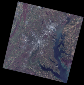
This, to me, is a much more recognizable image.
The purpose of this to me was to used locations in which I am specific to see how granular the satellite imagery will get. Now, I have some context as to how most effectively I can use Landsat.